Best iPhone 3D room scanner apps (2026)

A room scanner app turns a walk through a room with your iPhone into a floor plan, a 3D model or a 3D tour, with the measurements included. The best one depends on which of those you need. For a measured floor plan and a 3D tour you can send as a link, use FloorLens. For a floor plan drawn for you from a phone scan, CubiCasa. For an immersive tour, Matterport. For a 3D model to open in other software, Polycam. For detailed 3D captures and Gaussian splats, Scaniverse. For job-site reports and estimates, magicplan. Below is what a room scan gives you, which iPhones can scan at all, what each app does, and what you can do without paying.
What a room scanner app gives you
Most apps on this list start the same way: you hold the phone up and walk through the room while it records. What comes out at the end is where they differ, and it is the thing to choose by. There are four kinds of result.
- A floor plan with measurements. Walls, doors and windows drawn from above, with wall lengths and room areas. This is what goes on a property listing, into a renovation quote or onto a furniture plan.
- A 3D model. The room as a three-dimensional object you can turn and look into, sometimes textured so it looks like the real room, sometimes as plain surfaces.
- A 3D tour. The model, or a set of photos, that someone else can walk through in a browser, opened from a link.
- Files for other software. A model in a format such as OBJ, GLB or USDZ, or a plan as PDF or DXF, to open in CAD, a 3D editor or an estimating tool.
Two more differences matter once you know which result you want. The first is when it is ready: some apps build the plan on the phone while you scan, others upload the capture and send the plan back later. The second is how far one scan goes: a single room, a flat, or a house with several floors. If you only need a single wall length, you may not need a scanner app at all; see how to measure a room with an iPhone for when the built-in Measure app is enough.
Which iPhone do you need?
Room scanner apps capture a room in one of two ways, and the way decides which phone you need. LiDAR, the depth sensor on Pro iPhones, measures distances directly. It is on Pro and Pro Max models from the iPhone 12 Pro onward and on iPad Pro models from 2020. An iPhone 13 Pro, 16 Pro or 17 Pro has it; an iPhone 13, 16 or 17e does not, and neither do iPad Air and iPad mini. (Scanning is one of several things the sensor does: see how to use LiDAR on iPhone.)
Photogrammetry and video-based apps rebuild the space from overlapping camera images instead. They run on far more phones and can look very good, but the result takes processing time and the dimensions depend on that reconstruction. If you need measurements, LiDAR is the shorter route. If you care most about how the capture looks, or you do not have a Pro iPhone, the camera-based apps below are the ones to try.
Each statement about another app below links to that app's own website, as checked in October 2026. Features change often and prices more so, which is why this article lists no prices for other apps. Check the App Store listing and the pricing page before you commit.
Best for an instant floor plan and a shareable 3D tour: FloorLens
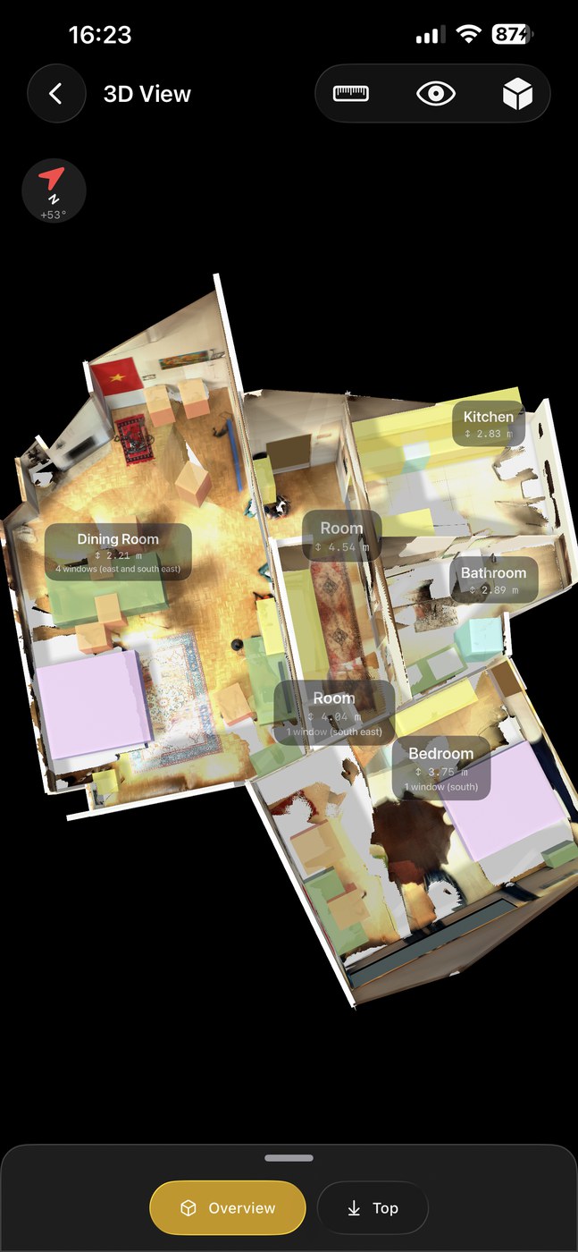
FloorLens turns a LiDAR scan into a floor plan and an editable 3D scene at the same time. Both are ready when the scan finishes, on the device, with no upload and no waiting. The measurements come with it: wall lengths, room areas, ceiling heights and the dimensions of objects, typically within a few centimetres across a room (see how accurate iPhone LiDAR is). You can then share the result as a browser-based 3D tour through a link and a QR code; the person who opens it needs no app and no login. Best for real estate agents and landlords who want one fast workflow and an easy way to hand clients a walkthrough, and for architects and renovators who want the measured state of a space on the first visit. A home with several floors is scanned one level at a time and aligned in the app into one model; the shared web viewer then shows the whole building with a floor plan per level. (See how to make a floor plan from a scan or how to share a 3D tour link.)
The limits are real: FloorLens needs a LiDAR iPhone or iPad running iOS 26 or later, and there is no Android version.
Lengths and areas from a phone scan are estimates, not a survey, and not legally binding. For a contract, a valuation or a filing, use a professional measurement.
Best for a floor plan drawn for you: CubiCasa
CubiCasa specialises in the floor plan itself. You walk through the property holding the phone at chest height while the app records, then upload the scan. Its help centre says the app supports a wide variety of iOS and Android devices, so it does not depend on LiDAR, and that plans come with a total area and, depending on the package, gross living area. The plan is processed rather than instant: CubiCasa gives the turnaround for a 2D floor plan as less than 24 hours and notes that this is not guaranteed. Best when the floor plan is the deliverable and it does not have to exist before you leave the property.
Best for immersive virtual tours: Matterport
Matterport's offer for property marketing is the immersive 3D tour, alongside floor plans and photos. It works at two levels. Its phone app runs on a long list of iPhones and on Android, and Matterport itself describes it as great for capturing a room or a small space in 3D without the need for a special camera. Beyond that it sells dedicated Pro2 and Pro3 cameras: the Pro2 for small to medium indoor spaces, the Pro3, a LiDAR camera, for high-resolution capture indoors and outdoors. Best for teams whose priority is the tour itself and who will invest in the cameras and the platform around them.
Best for exporting 3D models: Polycam
Polycam is a general 3D capture app for iPhone and Android that uses both photogrammetry and LiDAR. Its room scanner produces a 3D model with measurements, a first-person tour and a floor plan from one scan, and Polycam lists export in twelve or more file formats, including OBJ, FBX and glTF, with PDF for floor plans. Its photo mode builds a model from photos or a video alone, which makes it an option on phones without LiDAR. Best for 3D creators, designers and AEC users who need to take a scanned mesh into other software. If export is your main reason to scan, compare with exporting a room scan as GLB, USDZ or OBJ from FloorLens.
Best for detailed 3D captures and Gaussian splats: Scaniverse
Scaniverse, from Niantic Spatial, captures 3D scans on iOS and Android and generates Gaussian splats and meshes on the device. LiDAR is not required: its FAQ recommends an iPhone 13 or newer and says devices with LiDAR give the best results. It is a capture tool, not a floor plan tool, so it suits objects and spaces you want to keep or export in high fidelity. Note that Niantic Spatial now aims the new Scaniverse at organisations, with team-based scanning and data management, and describes the older Scaniverse Classic app as the one designed for individual use. Check what the current app offers an individual user before you rely on it.
Best for field documentation and estimates: magicplan
magicplan is built for the field, and its own site addresses restoration teams first. You sketch rooms with the device camera or manual tools, add photos and notes on site, start the estimate there, and export in the format the next person needs, such as PDF, DXF, PNG or ESX for Xactimate. It runs on iOS and Android. On an iPhone 12 Pro or later Pro model, its LiDAR Auto-Scan captures several rooms in one pass using Apple's RoomPlan. Best when the floor plan is one part of a larger job-site report.
What can you do for free?
Whether an app is free, and what its free tier leaves out, changes too often to list reliably for six products. Look at two places before you start a job: the "In-App Purchases" section of the App Store listing, and the app's own pricing page. Then check that the thing you need at the end, whether that is the floor plan file, the 3D export or the shared link, is part of what you get without paying.
For FloorLens the split is this. Free covers scanning (without texture), photos, editing, floor plans, measurements and every export: the PDF, the image formats, the 3D model and the fly-through video. It also covers one scan shared on the web at a time, which is deleted automatically after 14 days. Premium, at $6.99 a month, adds textured models, iCloud sync, up to three shared scans with 90-day links and PDFs with your own logo. The FloorLens plans are listed on the homepage.
How to choose
- You want a measured floor plan and a client-ready 3D tour before you leave the room: FloorLens.
- You want a floor plan drawn for you and can wait for it: CubiCasa.
- You want an immersive virtual tour and will invest in the platform: Matterport.
- You need to take 3D models into other tools: Polycam.
- You want detailed 3D captures or Gaussian splats: Scaniverse.
- You're documenting a job site and writing an estimate: magicplan.
- You don't have a Pro iPhone: CubiCasa, Matterport, magicplan or Polycam's photo mode.
Whichever app you pick, scan one room you know well first and check two or three walls against a tape measure. That tells you more about what to expect than any feature list. For a closer look at three of these, read FloorLens vs Matterport, CubiCasa and magicplan.
Frequently asked questions
What does a room scanner app do?
It turns a walk through a room with your phone into a measured result: a floor plan, a 3D model, a 3D tour you can share, or files for other software. Apps differ in which of these they produce and whether the result is ready on the phone or processed later.
What is the best iPhone app for scanning floor plans with LiDAR?
For a floor plan that is ready when the scan finishes, with measurements and a 3D tour you can share as a link, FloorLens. If the plan is part of a job-site report and estimate, magicplan's LiDAR Auto-Scan. Both need a LiDAR iPhone, an iPhone 12 Pro or later Pro model.
Which iPhones can scan a room in 3D?
LiDAR scanning needs a Pro or Pro Max iPhone from the iPhone 12 Pro onward, or an iPad Pro from 2020. Non-Pro iPhones have no LiDAR sensor, so on those you are limited to apps that work from the camera, from photos or from a video.
Do I need LiDAR to scan a room?
Not always. CubiCasa, Matterport, magicplan and Polycam's photo mode work without it. A LiDAR app such as FloorLens measures depth directly, so the floor plan and measurements are ready when the scan finishes.
Is there a free room scanner app for iPhone?
Yes. FloorLens is free to scan, measure, edit and export, including the PDF, the 3D model and the fly-through video, with one scan shared on the web at a time. Other apps change their free tiers often, so check each App Store listing.
Want the fast, share-in-one-tap option?
FloorLens is free to scan, measure and export. iPhone & iPad with LiDAR, iOS 26+.
Download on the App Store