As-built capture in minutes on the first site visit
The first site visit shouldn't be spent with a tape measure. Walk the space once with an iPhone and leave with a measured floor plan, ceiling heights, a textured 3D model and photos pinned where you took them. It's a record you and the client can come back to from the desk at any time.
Everything measured, automatically
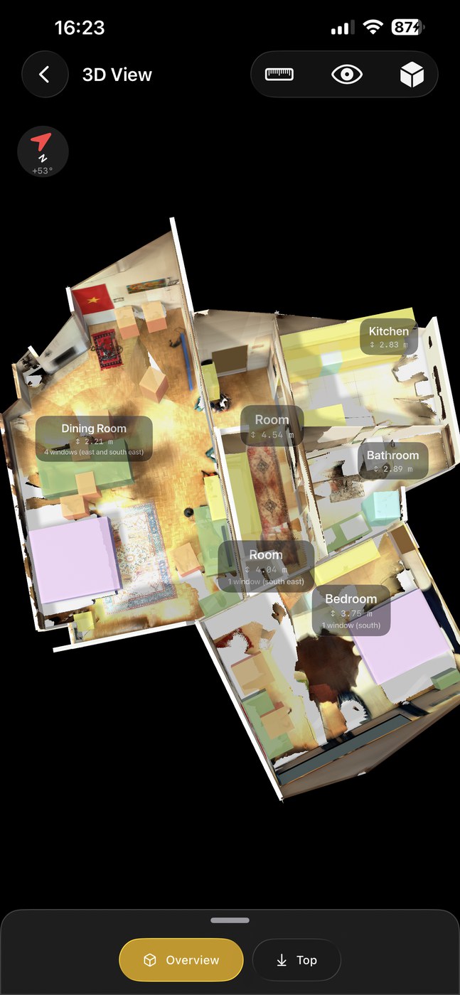
FloorLens derives wall lengths, room areas, ceiling heights and object dimensions from the LiDAR scan, and detects doors, windows and openings, plus each room's length × width. The floor plan is aligned to magnetic north and reports floor area in the standard of the country you pick: ANSI Z765, Gross Internal Area, IPMS 3.2 and 4.2, Wohnfläche (WoFlV), surface habitable, the Loi Carrez, SIA 416, NEN 2580 and more, for 39 countries. Each is measured to the correct face of the wall, with below-grade and unfinished space kept separate, so an area schedule needs less re-work before it goes to an agent or an appraiser. Accuracy is typically within a few centimetres, which is right for concept and schematic design, renovation quotes and client conversations. Construction-critical dimensions you verify on site as usual, and since the area figures are estimates from the scan rather than a survey, anything legally significant still needs measuring on site. (Curious how it works? What LiDAR on the iPhone actually does.)
The site, on your desk
Back at the office, the questions start. How high was the window sill? Which way does the bathroom door swing? Where exactly was that radiator? Instead of a return visit, open the scan: walk the space in first person, check the plan, and click any photo to see it pinned at its capture position. Multi-storey buildings stack into a dollhouse with per-level plans.
One link for the client and the trades
Share the scan as a browser link. The client sees the existing state in 3D without installing anything, and a contractor quoting remotely can check dimensions and conditions from the same link. Export the floor plan as a PDF or image for the project folder.
Document each phase
Scan before demolition, after first fix, at handover. Each scan is a dated 3D record with its own photos, so comparing states later (or settling a dispute about what was there before) is a matter of opening two scans.
What it costs
Scanning, measurements, floor plans and exports are free, with one web share included. Premium (from $6.99/month) adds baked textures, longer multi-scan sharing and branding. If you're weighing it against other tools, see how it compares to Matterport, CubiCasa and magicplan.
FloorLens is also used by real estate agents and landlords. More about the app and the developer behind it is on the about page.
Bring the site back from your next visit
Free to scan, measure and export. iPhone & iPad with LiDAR, iOS 26+.
Download on the App Store